|
15. Habitat characteristics
How do we observe a site where a particular species lives? Is it possible to recognize the spatial heterogeneity in the landscape that is essential for the survival of a population of that species? The fundamental question is how can a situation be described from a human point of view that relates to the requirements of an insect?
A start can be made at a site that has some special ecological qualities because of the presence of an interesting species. This site can be looked up on a topographical map scale 1:25.000 or 1:50.000;
alternatively the coordinates of the site can be read from a GPS-receiver. In Google-Chrome the site can be found on the satellite picture using the coordinates in hexagonal or decimal notation. The picture on the screen can be watched step by step from the detailed scale to the scale 1:25.000 which corresponds to the topographic map. The satellite picture can be zoomed from micro, meso to macro-scale. But how does the landscape looks through the eyes of a butterfly? What are the butterflies looking for? They will require a site to oviposit where the larvae will survive so that the butterfly will reach maturity.
However, the first question to be answered is: in what kind of landscape is the site situated?
Landscapes
There are many systems of classifying landscapes. The most familiar system is the one that can be read from a topographic map scale 1:25.000 on which the different types of landscape have symbols, which are described in the legend of the map. A map on this scale has as grid cell unit of 1km² and its size is 4 x 4 cm on the 1:25.000 scale. This scale is about the same as at step 6 of a Google-Chrome satellite picture (see table 9-3in chapter 9 ‘Behaviour in space’). Arbitrarily this scale is chosen here as landscape macro-scale. Landscape types are listed in table 15-1.
Table 15-1. Types of landscapes at macro-scale
| Landscape |
main characteristics |
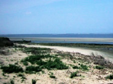
| Coasts |
strip between sea and land, beaches, cliffs, slopes on sea walls |
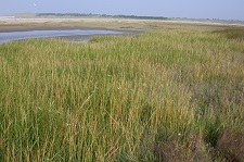
| Saltmarshes |
coastal grass vegetation on soils submerged at high tide |
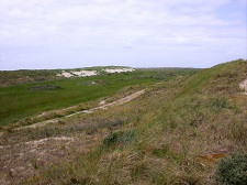
| Dunes |
hilly landscape on sand soils with a great variety of vegetation types |
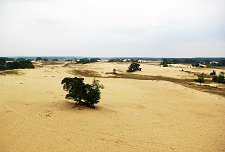
| Drift sands |
open landscape with spots of bare sand displaced by wind |
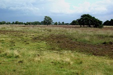
| Heathland |
open landscape dominated by heather and ling |
| Raised bogs |
open landscape, looks like heathland but with sedges and peat mosses |
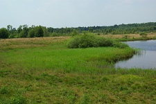
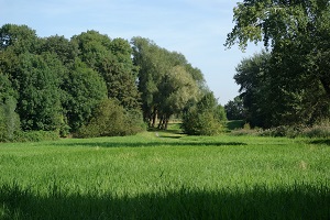
| Marshes |
landscape with various vegetation which is periodically water soaked |
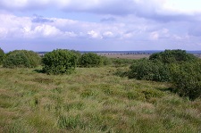
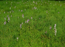
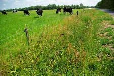
| Grasslands |
landscape of grass and herb vegetation of spontaneous origin |
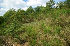
| Brushwood |
landscape dominated by shrubs up to 5 m high |
| Broad-leaved woods |
forest of deciduous trees such as oak and beech |
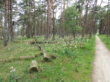
| Coniferous woods |
forest of coniferous trees, in the Benelux usually a spruce plantation |
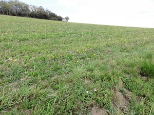
| Improved grassland |
grassland in agricultural use, fertilized and sown |
| Arable land |
land in agricultural use, ploughed and sown annually |
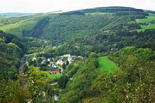
| Country side |
complex landscape used for agriculture, transport and housing |
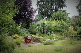
| Urban area |
complex landscape used for housing and industry |
Describing the habitat of a species starts from the point where the observer stays and looks around. He will notice the landscape and often also get an idea how this is shaped by the edaphic factors soil and climate and by human activity. Watching a few pictures per landscape type may tell something about what is going on and how this will rule the life of a butterfly.
|
However, the relation between landscape characteristics and requirements of a particular species cannot be traced using these rough descriptions. In botanical science classifications have been developed which are useful in describing a landscape in detail. The vegetation types are described using the species composition at selected spots (the biotope) and analysed using the edaphic (soil characteristics) growing conditions and occurrence (the ecotope). These data are the basis of classifications and can be used in describing the heterogeneity of a particular landscape. The vegetation classification has a practical purpose: mainly to read the growing conditions from the composition of the local occurring flora. The history of this landscape classification goes back many years and several different systems have been developed. For the Netherlands a handy field guide of plant communities was published by Schaminée et al. in 2010 and this guide is taken as a basis from which more detailed landscape descriptions are introduced. A more detailed picture of vegetation variety assists in the recognition of heterogeneity in the landscape. A more detailed picture, expressing the variety of the vegetation is useful in the characterization of the habitat of a particular species. A numerical classification code enables a compact description. Appendix 8 ‘Codes of selected vegetation units’ presents a list of vegetation types that can be used for describing the landscape heterogeneity. Table 15-2 presents an example how main landscape types can be specified in detail.
Table 15-2. Types of landscapes at macro-scale
| Landscape |
vegetation indication and classification code |
| Coasts |
- stripes of vegetation of salt resistant herbs (22. Cakiletea maritimae) |
| Saltmarshes |
- grass vegetation on tidal mud flat, (26. Asteretea tripolii) |
Dunes |
- rough vegetation of marram grass (23. Ammophiletea)
- scrub of sea buckthorn, privet, elder (37Ac Berberidion)
- grassland with violet and grey hair grass (14Aa2 Violo-Corynephoretum)
- grassland on poor chalk soil (14Cb Polygalo-Koelerion)
- heath with ling and crowberry (20Aa Calluno-Genistion piliosae)
- wood of elm and violet (43Aa1 Violo odoratae-Ulmetum) |
| Drift sands |
- sparse vegetation of spurrey and grey hair grass (14Aa1 Spergulo-Corynephoretum) |
| Heathland |
- heath on moist soil, mostly cross-leaved heath (11. Oxycocco-Spagnetea)
- heath on dry soil, mostly ling (20. Calluno-Ulicetea) |
| Raised bogs |
- furrows and banks with scheuchzeria and cotton grass (10. Scheuchzeritea)
- bulges of moss with cranberry and heath (11Ba Oxycocco-Ericion) |
| Marshes |
- tall vegetation of reed, sedges and herbs (8. Phragmitetea)
- short grassland of sedges and herbs (9. Parvocaricetea)
- rough herb vegetation near banks (32. Convolvulo-Filipenduletea)
|
| Grasslands |
- sparse grassland on scree or stony soil with stonecrop and knawel (13. Sedo-Scleranthetea)
- short grassland on poor soil with crested hair grass and grey hairy grass (14. Koelerio-Corynephoretea)
- tall grassland on dry chalk with brome and fescue (15. Festuco-Brometea)
- grassland on chalk with gentian and crested hair grass (15Aa1 Gentiano-Koelerietum)
- grassland on rich or moist soil with purple hair grass and oat grass (16. Molinio-Arrhenatheretea)
- grassland on moist peaty soil with rushes and purple hair grass (16Aa Junco-Molinion)
- rather tall grassland on moist soil, often used as hayfield (16Bb Alopecurion pratensis)
- grassland often used for sheep grazing (16Bc Cynosurion cristati)
- grassland on poor and moist soil with mat grass (19. Nardetea) |
| Brushwood |
- scrub with berry-bearing alder willow (36. Franguletea)
- scrub with buckthorn and blackthorn (37. Rhamno-Prunetea) |
| Broad-leaved woods |
- fringe of poplar and willow along riverbanks (38. Salicetea purpurea)
- carr of alder in marshes (39. Alnetea glutinosae)
- wood on poor and wet soil with brown birch (40. Vaccinio-Betuletea pubescentis)
- wood on poor soil with oak (42. Querco robori-petraeae)-wood on rich soil with oak, beech, hornbeam (43. Querco-Fagetea) |
| Coniferous woods |
- forest of coniferous trees, in the Benelux usually plantations with bilberry in the undergrowth (41. Vaccinio-Piceetea)
- brushwood of juniper on poor sand soil (41Aa1 Dicrano-Juniperetum) |
| Improved grassland |
- grassland in exploitation, sown and fertilized (12. Plantaginetea majoris) |
| Arable land |
- field yearly ploughed and sown (30. Stellarietea majoris) |
| Country side |
road sides, dikes, ditches, hedges, woodlots, banks,
- grass vegetation on rich soil yearly mown (16Bd Alopecurion pratensis)
- waste places on rich soil with tall herbs (31. Artemisietea vulgaris)
- river and pond banks with tall herbs (8. Phragmitetea) |
| Urban area |
walls, waste places, parks, gardens
- vegetation of herbs and fern on walls (21. Asplenietea tricomanis)
- waste places with tall herbs (31. Artemisietea vulgaris)
- weed in garden (30. Stellarietea mediae) |
Parts of landscape
However, to know what vegetation types are present, one has to make a field investigation but to qualify the heterogeneity of the landscape the detailed satellite picture will show the configuration of the landscape, the area of a particular vegetation type and the boundaries with others. Management advice for a site that focuses on safeguarding a particular species should be presented in a way understandable for people responsible for the management. This advice will mainly present an advice for landscape development and management. The presentation of a detailed satellite picture and an explanation how the species behaves over time and in space and what bottlenecks it may meet, will be the most useful ingredients in conservation planning. In a detailed satellite picture or an aerial photograph at scale 1:4000 or 1:12.500, the boundaries and spatial patterns of different vegetation types are visible. The botanical approach is focussed on community composition and process, whereas the entomological approach is the arrangement of the differences within the landscape and the spatial scale.
Most important is the ecological function of these parts for the particular species. Is a specified given part a place for reproduction, feeding or hibernating? This sort of questions will pass when the characterization of a habitat is the target.
Habitat
The word habitat has several meanings, here it is restricted to the set of requirements of a particular species. A site that has all the qualities for a thriving population can be considered as a habitat. But this is only applicable for species having spatial ‘stay-at-home’ behaviour as described in chapter 9. In the case of nomads and migrants the site may be suitable for a temporary stay to fulfil an episode of the lifecycle and it can be considered as an essential part of the habitat of a particular species. In this case a habitat cannot be characterized by observation at a site but only by summarising all the different habitat parts involved in the landscape. In the cases of not site bound occurrence (‘nomads’ and ‘migrants’) the spots selected by the egg laying butterflies or where the larva can be found are the places to investigate. Recording the places where the butterflies are observed contributes little to the knowledge of the habitat characteristics; it is the assembly of spots which are essential in the reproduction and development that are most informative.
So a successful habitat characterization of a species should take the spatial behaviour into account. This leads to the conclusion that only a small number of species will be suitable for habitat characterization by the traditional method.
Observed habitat characteristics differ with climate. In a cool climate the butterflies will select the warmest places, in a warm climate the coolest ones; obviously this can lead to completely different opinions about the specific habitat of a species.
Space and species
There are species of which their populations inhabit very small sites of less than one hectare, e.g. small blue (Cupido minimus) but also butterflies that use half of the European continent in the course of the seasons , e.g. the migrant red admiral (Vanessa atalanta).
The former species selects a site very precisely with young flowers of kidney vetch in an open vegetation, whereas the latter uses the ubiquitous stinging nettle for oviposition. However, a female red admiral shows that it is also very precise in selecting both the growing condition and position of the plant.
Each butterfly species has a particular relationship with space and environmental heterogeneity;
in mapping programs such relationships are not apparent. Distribution maps give only a vague idea about the space a species requires. In the Netherlands, in surveys the recording of observations are presented either at a 1km² or at a 5km² grid (‘uurhok’), in the United Kingdom at a 10km² grid and for European surveys a 50km² grid. Table 15-3 gives an idea of what grid sizes are appropriate to the different types of spatial behaviours of species. These kind of data are possibly applicable for characterization of the habitat size. Asher et al. (2001) discuss extensively the practicability of distribution maps.
Table 15-3. Spatial behaviour type connected to size of grid cells on topographical maps
| Spatial behaviour |
required area |
grid cell size |
| Stay-at-home, spatial requirement very modest |
1ha |
100 x 100 m |
| Stay-at-home, spatial requirement modest |
25ha |
500 x 500 m |
| Stay-at-home, spatial requirement considerable |
100ha |
1000 x 1000 m |
| Nomad, spatial requirement modest |
1km² |
1 x 1 km |
| Nomad, spatial requirement considerable |
25km² |
5 x 5 km |
| Nomad, spatial requirement great |
100km² |
10 x 10 km |
| Migrant, spatial requirement very great |
seasonal migration, arrival and departure |
| Vagrant, unpredictable in appearance |
considered as a member of the fauna |
| Stray, very rare and unpredictable in appearance |
not considered to be part of the fauna |
Appendix 6. Codes of selected vegetation units
|